Showing posts with label Stephenville. Show all posts

Thursday, 10 March 2016

Stephenville Area Trails

Stephenville is the gateway to the Port-au-Port Peninsula. If you like to hike, there are several great trails in the area ranging from easy to fairly challenging.

In this blog, links are orange. If you'd like more information about any of these trails, click the link which will take you to our Bob's Newfoundland page about that trail.

Erin Mountain Trail in Barachois Pond Provincial Park is quite challenging. The reward is a spectacular view of the park and Bay St. George. It is also very interesting to see the back country on the other side of the mountain.

The first section of the trail is very easy hiking with well maintained boardwalks and stairs. It takes you about 1/3 of the way up the mountain to a very nice lookout. The rest of the trail to the top of the mountain is fairly challenging. There are stairs, but there are also fairly steep climbs through a very rocky trail. In the Spring, you may be hampered by melting snow runoff, which tends to run down the trail.

When you reach the top of the mountain, take care to stay back from the edges. It can be very windy and weather conditions on the top of the mountain can vary a lot from the base. We went up on a very nice day and had lunch at the summit before our return hike. The total return time for us was about 4 hours.

The Blanche Brook Trail starts right in Stephenville and runs behind some businesses and homes. It's an easy trail that leads to remnants of a petrified forest. You don't have to be a geologist to easily identify the rocks in the stream bed that look like pieces of wood.

The Port-au-Port Peninsula is joined to Newfoundland by a narrow isthmus called The Gravels. It's natural, but looks like it's man-made. The parking lot for The Gravels Trail is on your right just across the isthmus.

The trail is easy hiking and is incredibly well maintained. It's quite lengthy with a couple of offshoot trails. You can decide to do part of it if you like, because it follows the shore of Port-au-Port Bay. It's spectacular scenery all the way.
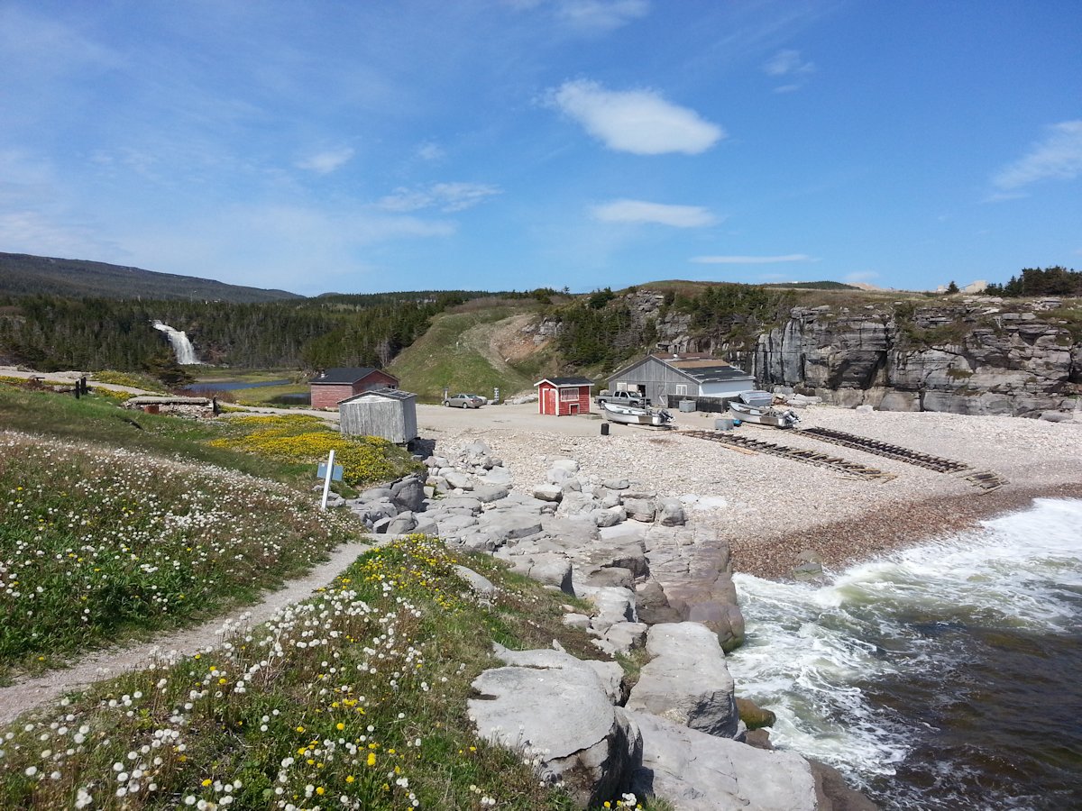
Don't miss out on driving The French Ancestral Route around the Port-au-Port Peninsula. You will want to stop at the Hidden Falls in Sheaves Cove. It's well named, you could drive right through town and have no idea it was there. If you are not a hiker, you can see the falls from the parking lot. You'll be amazed to learn that all the trails were built and maintained by a local lobster fisherman and property owner. There are two trails. One takes you closer to the foot of the falls. The second trail goes along Bay St. George to a second waterfall that's right at the edge of the bay.

Boutte du Cap at Cape St. George is home to some of the most spectacular scenery on the peninsula. When you drive into the park, the first things you see are the Acadian Monument and a traditional bread oven. The Bread Crumb trail starts behind the bread oven. It's an easy trail that's not really long.

Drive to the end of the point and there are two trails that take you to kittiwake colonies. These trails are more challenging. There is a pretty good climb on the upper trail. The cliffs here are breath-taking, the photographs cannot due them justice.

Tuesday, 5 January 2016

Western Newfoundland Geology

Newfoundland's nickname is 'The Rock'. It does not matter what part of the island you visit, you'll see lots of rock. The province boasts several sites that have great geological significance.

While walking trails we often find ourselves wondering how the various interesting formations came about. Our understanding of geology is pretty limited. We purchased a great book titled 'Geology of Newfoundland' by Martha Hickman Hild, available from Boulder Publications. The book has GPS co-ordinates, photos and descriptions of 48 sites across the island. The level of information will satisfy serious rock hounds. In our case, we are able to glean enough to satisfy our curiosity. We keep the book in the truck, it does not matter what part of the island you are visiting, there will be an interesting site nearby.

Western Newfoundland has the oldest rocks on the island. When you take the Western Brook Pond boat tour, you'll see the Long Range Mountains close up. The rock you are looking at was formed 1.5 billion years ago. The boat crew does a good job of explaining what you are seeing.

When you are in Western Newfoundland, we'd recommend 4 other very interesting sites for looking at rocks. In Gros Morne, you'll also want to visit Green Point and The Tablelands. Stop in Stephenville and you can check out a petrified forest along the Blanche Brook Trail. Finally, on the Port au Port Peninsula, we really enjoyed checking out the folded rocks at Piccadilly.

Green Point

At Green Point you are looking at millions of years worth of sedimentary rock formed at the bottom of an ancient ocean. The layers of shale and limestone have been shifted dramatically so they are vertical, not horizontal. Looking at the cliff from the beach you are seeing a time record. The older layers of rock are to your right, the younger layers to the left.

There is a layer in the middle of the cliff that marks the dividing line between the older Cambrian period and the newer Ordovician period. This all happened just under 500 million years ago. Green Point has been designated as an International reference point for the geological time scale. Apparently there have been lots of geologists studying this cliff.

It's not difficult to get down to the base of the cliffs. The tricky part is timing. You want to go late in the afternoon at low tide. Somehow we lucked upon the right time. It allows you to get further out on the rocky beach to get a better look at the cliff. It also allows you to see all the vertical layers of rock coming out of the beach at a 90° angle. The walking is a bit tricky on the jagged rocks. For more information on where Green Point is and more photos, you can visit our web page.

The Tablelands

This area in the southern section of Gros Morne National Park is very similar to the surface of Mars. It's a large area where the earth's mantle is exposed. The reddish, yellowish rock is peridotite. It's chemically unstable and water that seeps through it's cracks is slowly changing it to another type of rock called serpentinite. This process also alters the water chemistry. This recipe does not support plant life. The Martian surface is also largely made up of peridotite and serpentinite.

There are lots of ways to see The Tablelands. The simplest is to just drive the road from Woody Point to Trout River. There is a trail that you can hike on your own or with a guided walk by Parks Canada. You can also get another view of The Tablelands by going on the Trout River Pond boat tour.

Blanche Brook

The fossil trees along Blanche Brook are also very easy to get to. The trail starts right in Stephenville, next to an ATV dealer. You hike in about 1 km along the rocky stream. We first noticed what we thought were logs that the shallow water was flowing over. On closer inspection these were actually rocks. You need to get out and walk in the stream bed and you'll find lots of pieces of petrified wood. Don't take souvenirs, you need to leave it the way you find it for the next hiker.

The trees are all the same species of primitive tree that is now extinct. They probably grew to a height of 48 metres and were some of the tallest trees of their time period.

The Folded Rocks

This is located quite close to Stephenville in Piccadilly on the Port au Port Peninsula. It's right along an easy to walk beach. It is a bit of a scramble to get down to the beach. This feature is not in any of the tour books, but well worth checking out. There are no signs giving directions and there are no interpretive signs once you reach that portion of the cliff.

You will see layers of sandstone and crumbly dark shale. Forces folded the stronger sandstone layers into this interesting formation. Several of the sandstone layers are folded bottom up, so you can see what both the top and bottom of each layer looks like.

You can stop at the Parkview Variety in Piccadilly for gas and munchies. They gave us good instructions on finding the folded rocks. We've detailed it on our Piccadilly web page.

Monday, 17 August 2015

Where to Buy Cookies in Kippens

We spent 8 nights in Kippens, Newfoundland exploring the Port au Port Peninsula and the Stephenville area. We stayed at the Zenzville RV Park.

Zenzville RV Park


Kippens is a bedroom community for Stephenville. You drive through Kippens to get to the Port au Port Peninsula. There is not a lot to see or do in Kippens. It's in a pretty spot on St. George's Bay. Here's a photo, coming out of the driveway from the campground:


There are some unusual white cliffs that you see coming into Kippens from the west (from Port au Port, driving towards Stephenville). I did not take a photo, but here's what it looks like on Google Street View.

They look like the hoodoos that you see near Banff. I have not been able to find any brochures or websites explaining what they are. If you know, please drop in a comment.

Jennifer's Sweet Occasions

Click here for the mapped location of The Cake & Pastry Shop.

They were very busy when we were there getting ready for weddings and other functions. They have great cookies. It's a great place to get some road food for your Port au Port scenic drive.

For lots of great places to see in Western and Central Newfoundland, please visit our Newfoundland Travel Website.